|
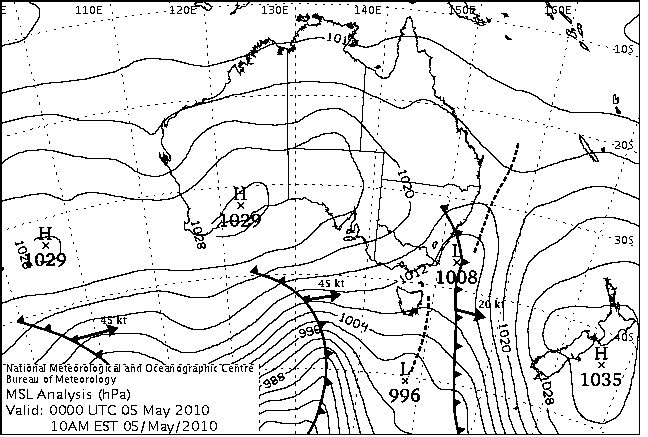
For notes on how to interpret
the data and quality control issues, see Daily Weather Summary Help.
**S** and **W** precede data flagged by the Bureau as suspicious or wrong
Data is as received at 17:12EST, 23/05/2012.
|
|
| |
Max
°
C |
+/- norm
°
C |
Min
°
C |
+/- norm
°
C |
Grass Min
°
C |
Rain to 9am mm |
Evaporation to 9am mm |
Sunshine hours |
Wind Run to 9am km (24-hour average km/h) |
Maximum Gust km/h / hour of occurrence |
| GERALDTON AIRPORT |
32.3 |
+8.3 |
13.6 |
+0.7 |
11.3 |
0.0 |
6.2 |
-- |
479 (20.0) |
35/08 |
| PERTH AIRPORT |
25.8 |
+4.1 |
7.4 |
-3.1 |
4.8 |
0.0 |
3.4 |
9.8 |
-- |
35/06 |
| ALBANY AIRPORT |
19.4 |
+0.5 |
4.7 |
-5.1 |
1.0 |
0.0 |
1.6 |
8.8 |
171 ( 7.1) |
18/08 |
| BUNBURY |
22.4 |
+1.3 |
6.4 |
-3.1 |
-- |
0.0 |
-- |
-- |
201 ( 8.4) |
24/14 |
| MANDURAH |
23.9 |
-- |
11.2 |
-- |
-- |
0.0 |
-- |
-- |
220 ( 9.2) |
28/13 |
| DARWIN AIRPORT |
33.9 |
+1.9 |
25.5 |
+3.4 |
24.5 |
0.0 |
6.6 |
11.2 |
481 (20.0) |
59/11 |
| ALICE SPRINGS AIRPORT |
22.4 |
-0.6 |
10.1 |
+1.8 |
8.5 |
0.0 |
11.4 |
-- |
211 ( 8.8) |
39/09 |
| WHYALLA AERO |
20.0 |
-0.5 |
7.7 |
-1.0 |
-- |
0.0 |
6.8 |
-- |
387 (16.1) |
34/13 |
| ADELAIDE (KENT TOWN) |
17.1 |
-1.9 |
11.1 |
+0.9 |
7.7 |
1.4 |
3.0 |
3.2 |
405 (16.9) |
48/12 |
| MOUNT GAMBIER AERO |
14.6 |
-1.5 |
5.2 |
-2.1 |
3.8 |
4.8 |
2.0 |
2.6 |
392 (16.3) |
43/16 |
| MOUNT ISA AERO |
31.8 |
+3.9 |
19.6 |
+5.7 |
17.1 |
0.0 |
7.0 |
11.0 |
305 (12.7) |
41/13 |
| CAIRNS AERO |
29.2 |
+1.6 |
21.5 |
+1.6 |
20.2 |
0.2 |
4.0 |
9.5 |
427 (17.8) |
37/12 |
| TOWNSVILLE AERO |
29.7 |
+2.1 |
21.3 |
+3.7 |
18.3 |
0.0 |
8.0 |
7.7 |
341 (14.2) |
31/14 |
| MACKAY M.O |
26.1 |
+1.9 |
19.3 |
+2.2 |
-- |
0.0 |
-- |
9.9 |
370 (15.4) |
30/08 |
| ROCKHAMPTON AERO |
30.1 |
+4.1 |
17.0 |
+2.8 |
15.0 |
0.0 |
5.8 |
-- |
228 ( 9.5) |
30/13 |
| BUNDABERG AERO |
28.7 |
+4.0 |
16.3 |
+2.1 |
-- |
0.3 |
3.3 |
-- |
258 (10.8) |
22/15 |
| NAMBOUR DPI |
-- |
-- |
15.0 |
+3.0 |
-- |
9.0 |
-- |
-- |
-- |
-- |
| COOLANGATTA |
26.5 |
+3.4 |
15.7 |
+1.4 |
-- |
7.2 |
-- |
-- |
148 ( 6.2) |
-- |
| BRISBANE AERO |
25.7 |
+2.1 |
15.6 |
+2.8 |
13.0 |
16.2 |
0.0 |
8.7 |
206 ( 8.6) |
26/20 |
| TOOWOOMBA AIRPORT |
24.6 |
+4.6 |
12.9 |
+2.9 |
-- |
1.0 |
-- |
-- |
380 (15.8) |
39/14 |
| GUNNEDAH RESOURCE CENTRE |
25.4 |
+5.1 |
11.1 |
+2.4 |
6.8 |
0.0 |
2.8 |
-- |
90 ( 3.8) |
-- |
| COFFS HARBOUR MO |
24.3 |
+2.9 |
14.4 |
+2.7 |
11.6 |
6.4 |
1.0 |
10.3 |
214 ( 8.9) |
30/23 |
| PORT MACQUARIE AIRPORT AWS |
25.8 |
+4.3 |
13.0 |
+2.5 |
-- |
4.0 |
-- |
-- |
-- |
-- |
| WILLIAMTOWN RAAF |
26.4 |
+6.2 |
9.5 |
-0.6 |
7.5 |
0.0 |
2.6 |
8.9 |
275 (11.5) |
-- |
| GOSFORD (NARARA RESEARCH STATION) AWS |
24.1 |
+3.7 |
9.9 |
+1.6 |
-- |
0.0 |
-- |
-- |
45 ( 1.9) |
43/12 |
| ORANGE AGRICULTURAL INSTITUTE |
10.2 |
-4.0 |
6.2 |
+1.5 |
0.8 |
15.0 |
3.0 |
8.0 |
-- |
-- |
| DUBBO AIRPORT AWS |
16.9 |
-3.1 |
11.9 |
+5.1 |
-- |
7.4 |
-- |
-- |
267 (11.1) |
43/13 |
| SYDNEY AIRPORT AMO |
22.5 |
+2.5 |
15.1 |
+4.2 |
10.0 |
0.0 |
3.8 |
5.9 |
395 (16.5) |
65/15 |
| RICHMOND RAAF |
22.2 |
+1.6 |
9.6 |
+1.7 |
5.9 |
0.0 |
-- |
-- |
148 ( 6.2) |
54/13 |
| BELLAMBI AWS |
21.3 |
+1.6 |
16.7 |
+3.6 |
-- |
0.0 |
-- |
-- |
495 (20.6) |
76/18 |
| CANBERRA AIRPORT |
13.1 |
-2.5 |
9.5 |
+6.3 |
9.0 |
16.6 |
-- |
-- |
-- |
-- |
| WAGGA WAGGA AMO |
14.6 |
-2.7 |
9.3 |
+3.4 |
8.0 |
7.4 |
5.2 |
7.5 |
378 (15.8) |
43/13 |
| ALBURY AIRPORT AWS |
14.5 |
-3.2 |
8.9 |
+3.3 |
-- |
3.0 |
-- |
-- |
309 (12.9) |
39/15 |
| MILDURA AIRPORT |
17.8 |
-1.2 |
5.5 |
-1.9 |
3.0 |
0.0 |
4.6 |
5.6 |
392 (16.3) |
35/13 |
| TATURA INST SUSTAINABLE AG |
15.3 |
-2.0 |
4.7 |
-1.1 |
-- |
1.8 |
3.6 |
-- |
388 (16.2) |
37/14 |
| BENDIGO AIRPORT |
14.7 |
-1.9 |
2.7 |
-2.5 |
-- |
4.6 |
-- |
-- |
241 (10.0) |
�
37/13 |
| MELBOURNE REGIONAL OFFICE |
17.3 |
+0.6 |
9.1 |
+0.5 |
5.4 |
4.2 |
3.8 |
-- |
-- |
-- |
| GEELONG AIRPORT |
15.4 |
-1.7 |
6.2 |
-1.5 |
-- |
3.2 |
-- |
-- |
569 (23.7) |
48/15 |
| BALLARAT AERODROME |
11.3 |
-2.3 |
2.3 |
-3.4 |
-- |
7.4 |
-- |
-- |
375 (15.6) |
41/14 |
| LAUNCESTON (TI TREE BEND) |
15.7 |
-0.1 |
6.5 |
+1.4 |
-- |
10.0 |
-- |
-- |
194 ( 8.1) |
26/22 |
| HOBART AIRPORT |
16.1 |
+0.9 |
8.0 |
+1.4 |
4.0 |
1.6 |
3.2 |
8.1 |
478 (19.9) |
39/11 |
| |
Max
°
C |
+/- norm
°
C |
Min
°
C |
+/- norm
°
C |
Grass Min
°
C |
Rain to 9am mm |
Evaporation to 9am mm |
Sunshine hours |
Wind Run to 9am km |
Maximum Gust km/h / hour of occurrence |
|
| Hottest |
| Highest maximum temperature> | Greatest variation above normal maximum |
Highest minimum temperature | Greatest variation above normal minimum |
38.7 MARDIE W Pilbara WA
38.1 BIDYADANGA W Kimberley WA
38.0 PARDOO STATION E Pilbara WA
37.7 ROEBOURNE AERO E Pilbara WA
37.5 PORT HEDLAND AIRPORT E Pilbara WA
37.5 ROEBOURNE E Pilbara WA
37.5 ONSLOW AIRPORT W Pilbara WA
|
+10.7 : 36.9 CARNARVON AIRPORT W Gascoyne WA
+9.5 : 35.3 DENHAM W Gascoyne WA
+9.1 : 35.1 KALBARRI Central West WA
+8.5 : 32.2 MULLEWA Central West WA
+8.4 : 37.5 ONSLOW AIRPORT W Pilbara WA
**S** +8.4 : 31.1 KULGERA N Plateau NT
|
29.0 TROUGHTON ISLAND N Kimberley WA
27.3 HORN ISLAND N Peninsula QLD
27.2 COCONUT ISLAND N Peninsula QLD
27.0 BEDOUT ISLAND E Pilbara WA
26.2 WILLIS ISLAND Islands ISL
|
+7.4 : 23.0 WOLLOGORANG N Rivers NT
+6.9 : 14.0 MORUYA AIRPORT AWS South Coast NSW
+6.8 : 8.8 BOMBALA (THERRY STREET) Goulburn/Monaro NSW
+6.8 : 19.2 TOM PRICE W Pilbara WA
+6.7 : 9.9 GOULBURN AIRPORT AWS Goulburn/Monaro NSW
|
| Coldest |
| Lowest maximum temperature | Greatest variation below normal maximum |
Lowest minimum temperature | Greatest variation below normal minimum |
-0.7 THREDBO AWS Snowy Mtns NSW
-0.3 MT HOTHAM Upper NE VIC
0.1 FALLS CREEK Upper NE VIC
1.0 MOUNT GININI AWS Goulburn/Monaro NSW
1.8 MOUNT BULLER Upper NE VIC
1.8 PERISHER VALLEY SKI CENTRE Snowy Mtns NSW
|
-6.5 : 2.3 CABRAMURRA SMHEA AWS SW Slopes S NSW
-6.3 : 0.1 FALLS CREEK Upper NE VIC
-6.1 : 1.8 PERISHER VALLEY SKI CENTRE Snowy Mtns NSW
-5.6 : -0.7 THREDBO AWS Snowy Mtns NSW
-5.2 : -0.3 MT HOTHAM Upper NE VIC
|
-2.7 MOUNT BULLER Upper NE VIC
-2.5 MT HOTHAM Upper NE VIC
-2.0 MT BAW BAW W Gippsland VIC
-1.5 THREDBO AWS Snowy Mtns NSW
-1.4 FALLS CREEK Upper NE VIC
|
-6.8 : 3.2 WITCHCLIFFE Lower West WA
-6.6 : 0.6 SALMON GUMS RES.STN. Goldfields WA
-6.4 : 0.5 JARRAHWOOD Lower West WA
-6.2 : 3.3 ROCKY GULLY Lower West WA
-6.2 : 2.5 ONGERUP Cent Wheatbelt WA
|
|
Sunniest &
dullest |
Windiest |
Highest gusts |
Todays highest rainfall totals for the 24 hours to 9am. It
includes the top 5 totals nationally followed by all reported falls of 50mm or more. |
Highest
and lowest recordings of hours of sunshine for the 24 hours to midnight. |
Highest wind
run totals in kilometres for the 24 hours to 9am (average speed in brackets).
All reported runs >
=25km/h are shown. |
Highest wind
gusts in km/h for the 24 hours to midnight followed by the hour in which it occurred.
All stations with gusts >
89km/h are shown. |
287.0 LEIGH RIVER @ MOUNT MERCER Western Plains VIC
73.0 CARBROOK LONGLAND ROAD Brisbane/SE Coast QLD
61.8 WILSONS PROMONTORY LIGHTHOUSE W Gippsland VIC
57.4 LITTLE NERANG DAM Brisbane/SE Coast QLD
52.2 EVANS HEAD RAAF BOMBING RANGE AWS North Coast NSW
QUEENSLAND
Brisbane/SE Coast
73.0 CARBROOK LONGLAND ROAD
57.4 LITTLE NERANG DAM
51.0 WUNBURRA
NEW SOUTH WALES
North Coast
52.2 EVANS HEAD RAAF BOMBING RANGE AWS
VICTORIA
W Gippsland
61.8 WILSONS PROMONTORY LIGHTHOUSE
Western Plains
287.0 LEIGH RIVER @ MOUNT MERCER
|
11.2 DARWIN AIRPORT N Rivers NT
11.0 MOUNT ISA AERO Gulf Country QLD
10.8 GILES METEOROLOGICAL OFFICE Interior WA
10.7 TENNANT CREEK AIRPORT N Plateau NT
10.5 BROOME AIRPORT W Kimberley WA
10.5 RABBIT FLAT N Plateau NT
.....
2.6 MOUNT GAMBIER AERO Lower SE SA
2.4 STRATHGORDON VILLAGE W Coast TAS
2.3 ADELAIDE AIRPORT Adelaide/Lofty SA
1.9 NURIOOTPA VITICULTURAL Adelaide/Lofty SA
1.8 CEDUNA AMO W Agricultural SA
|
1088 (45.3) MOUNT WELLINGTON Southeast TAS
1013 (42.2) MOUNT HOTHAM Upper NE VIC
1008 (42.0) NEPTUNE ISLAND W Agricultural SA
999 (41.6) THREDBO AWS Snowy Mtns NSW
**S** 994 (41.4) HOGAN ISLAND Islands ISL
936 (39.0) MAATSUYKER ISLAND LIGHTHOUSE Southeast TAS
842 (35.1) FALLS CREEK Upper NE VIC
797 (33.2) WILLIS ISLAND Islands ISL
789 (32.9) LORD HOWE ISLAND AERO Islands ISL
784 (32.7) MOUNT BULLER Upper NE VIC
762 (31.8) CAPE FLATTERY N Coast--Barron QLD
751 (31.3) CAPE BORDA Yorke Pen/Kanga Is SA
746 (31.1) COLAC (MOUNT GELLIBRAND) W Coast VIC
745 (31.0) CAPE JAFFA (THE LIMESTONE) Lower SE SA
730 (30.4) ADELAIDE AIRPORT Adelaide/Lofty SA
727 (30.3) CAPE WILLOUGHBY Yorke Pen/Kanga Is SA
725 (30.2) MONTAGUE ISLAND LIGHTHOUSE South Coast NSW
688 (28.7) LOW ISLES LIGHTHOUSE N Coast--Barron QLD
686 (28.6) STENHOUSE BAY Yorke Pen/Kanga Is SA
682 (28.4) HARTZ MOUNTAIN (KEOGHS PIMPLE) Southeast TAS
664 (27.7) NORTH ISLAND Central West WA
657 (27.4) COCOS ISLAND AIRPORT Islands ISL
646 (26.9) NORFOLK ISLAND AERO Islands ISL
643 (26.8) GREEN CAPE AWS South Coast NSW
638 (26.6) WILSONS PROMONTORY LIGHTHOUSE W Gippsland VIC
638 (26.6) FLINDERS ISLAND AIRPORT Flinders Is/Bass St TAS
636 (26.5) GABO ISLAND LIGHTHOUSE E Gippsland VIC
636 (26.5) CAPE GRIM BAPS N Coast TAS
633 (26.4) HAMILTON ISLAND AIRPORT Central Coast E QLD
626 (26.1) LOW HEAD N Coast TAS
601 (25.0) SCOTTS PEAK DAM W Coast TAS
|
98/22 MAATSUYKER ISLAND LIGHTHOUSE Southeast TAS
94/22 HOGAN ISLAND Islands ISL
91/21 WILSONS PROMONTORY LIGHTHOUSE W Gippsland VIC
89/23 CAPE GRIM BAPS N Coast TAS
81/22 MOUNT WELLINGTON Southeast TAS
|
�