|
For notes on how to interpret
the data and quality control issues, see Daily Weather Summary Help.
**S** and **W** precede data flagged by the Bureau as suspicious or wrong
Data is as received at 23:09EST, 14/05/2012.
|
|
| |
Max
°
C |
+/- norm
°
C |
Min
°
C |
+/- norm
°
C |
Grass Min
°
C |
Rain to 9am mm |
Evaporation to 9am mm |
Sunshine hours |
Wind Run to 9am km (24-hour average km/h) |
Maximum Gust km/h / hour of occurrence |
| GERALDTON AIRPORT |
22.5 |
+2.5 |
10.5 |
+1.6 |
8.9 |
0.0 |
3.2 |
-- |
328 (13.7) |
30/13 |
| PERTH AIRPORT |
21.5 |
+3.1 |
9.8 |
+1.8 |
8.8 |
2.4 |
2.0 |
7.2 |
262 (10.9) |
54/20 |
| ALBANY AIRPORT |
19.7 |
+3.6 |
5.6 |
-1.9 |
2.7 |
0.0 |
2.6 |
8.2 |
320 (13.3) |
54/16 |
| BUNBURY |
19.2 |
+1.9 |
10.0 |
+2.4 |
-- |
5.0 |
-- |
-- |
180 ( 7.5) |
54/12 |
| MANDURAH |
18.6 |
-- |
12.2 |
-- |
-- |
3.4 |
-- |
-- |
273 (11.4) |
72/19 |
| DARWIN AIRPORT |
30.7 |
-0.6 |
18.8 |
-1.6 |
17.7 |
0.0 |
7.0 |
10.6 |
374 (15.6) |
48/12 |
| ALICE SPRINGS AIRPORT |
25.2 |
+2.6 |
3.4 |
-2.6 |
-1.2 |
0.0 |
5.4 |
11.1 |
192 ( 8.0) |
21/12 |
| WHYALLA AERO |
17.8 |
-0.7 |
7.6 |
+1.7 |
-- |
0.0 |
5.0 |
-- |
399 (16.6) |
24/13 |
| ADELAIDE (KENT TOWN) |
18.2 |
+1.5 |
11.0 |
+2.8 |
5.6 |
0.0 |
4.0 |
4.6 |
259 (10.8) |
26/12 |
| MOUNT GAMBIER AERO |
15.8 |
+1.7 |
6.0 |
+0.5 |
1.6 |
0.0 |
3.4 |
5.6 |
371 (15.5) |
35/15 |
| MOUNT ISA AERO |
27.7 |
+0.4 |
5.7 |
-4.6 |
2.6 |
0.0 |
5.0 |
10.9 |
172 ( 7.2) |
34/10 |
| CAIRNS AERO |
25.8 |
-0.8 |
18.7 |
+1.3 |
17.2 |
4.4 |
5.8 |
10.9 |
512 (21.3) |
41/09 |
| TOWNSVILLE AERO |
26.3 |
+0.3 |
12.3 |
-2.4 |
8.1 |
0.0 |
5.2 |
10.8 |
437 (18.2) |
39/14 |
| MACKAY M.O |
22.3 |
-0.2 |
13.0 |
-1.0 |
-- |
0.0 |
-- |
10.8 |
346 (14.4) |
28/11 |
| ROCKHAMPTON AERO |
26.1 |
+1.3 |
8.1 |
-2.5 |
6.2 |
0.0 |
4.0 |
-- |
156 ( 6.5) |
26/17 |
| BUNDABERG AERO |
24.5 |
+1.2 |
10.2 |
-0.7 |
-- |
0.0 |
3.8 |
-- |
173 ( 7.2) |
30/14 |
| NAMBOUR DPI |
26.1 |
+3.6 |
7.0 |
-1.0 |
-- |
0.0 |
7.6 |
-- |
-- |
24/11 |
| COOLANGATTA |
21.6 |
+0.3 |
13.7 |
+3.3 |
-- |
0.0 |
-- |
-- |
281 (11.7) |
30/13 |
| BRISBANE AERO |
23.0 |
+1.2 |
8.3 |
-1.3 |
4.1 |
0.0 |
3.0 |
10.4 |
264 (11.0) |
34/09 |
| TOOWOOMBA AIRPORT |
20.9 |
+2.2 |
7.7 |
+0.2 |
-- |
0.0 |
-- |
-- |
330 (13.8) |
39/12 |
| GUNNEDAH (DIPNR) |
20.1 |
+2.2 |
4.8 |
-1.0 |
-2.5 |
0.0 |
3.4 |
-- |
76 ( 3.2) |
-- |
| COFFS HARBOUR MO |
20.9 |
+1.1 |
7.4 |
-0.8 |
2.7 |
0.0 |
2.0 |
10.5 |
155 ( 6.5) |
18/11 |
| PORT MACQUARIE AIRPORT AWS |
21.0 |
+0.8 |
7.6 |
+0.9 |
-- |
0.0 |
-- |
-- |
-- |
-- |
| WILLIAMTOWN RAAF |
21.3 |
+2.7 |
3.4 |
-3.4 |
1.4 |
0.0 |
2.4 |
10.5 |
203 ( 8.5) |
32/11 |
| GOSFORD (NARARA RESEARCH STATION) AWS |
21.5 |
+2.5 |
3.0 |
-2.3 |
0.2 |
0.2 |
-- |
-- |
41 ( 1.7) |
18/11 |
| ORANGE AGRICULTURAL INSTITUTE |
13.6 |
+2.6 |
-0.6 |
-2.7 |
-6.0 |
0.0 |
2.0 |
9.5 |
-- |
-- |
| DUBBO AIRPORT AWS |
19.1 |
+1.6 |
-2.6 |
-6.0 |
-- |
0.0 |
-- |
-- |
-- |
-- |
| SYDNEY AIRPORT AMO |
21.9 |
+3.6 |
8.2 |
+0.1 |
4.9 |
0.0 |
2.6 |
10.7 |
324 (13.5) |
34/11 |
| RICHMOND RAAF |
20.2 |
+0.4 |
0.0 |
-4.4 |
-- |
0.0 |
-- |
-- |
84 ( 3.5) |
18/14 |
| BELLAMBI AWS |
21.4 |
+3.4 |
11.0 |
+0.5 |
-- |
0.0 |
-- |
-- |
297 (12.4) |
31/08 |
| CANBERRA AIRPORT |
16.6 |
+3.6 |
-3.0 |
-4.0 |
-6.6 |
0.0 |
1.4 |
8.9 |
192 ( 8.0) |
41/16 |
| WAGGA WAGGA AMO |
18.5 |
+4.0 |
-1.5 |
-5.1 |
-4.8 |
0.0 |
2.0 |
10.3 |
141 ( 5.9) |
18/12 |
| ALBURY AIRPORT AWS |
18.0 |
+3.0 |
0.2 |
-3.6 |
-- |
0.0 |
-- |
-- |
42 ( 1.8) |
18/10 |
| MILDURA AIRPORT |
20.3 |
+3.1 |
6.2 |
+1.0 |
-0.4 |
0.0 |
4.2 |
9.6 |
325 (13.5) |
30/12 |
| TATURA INST SUSTAINABLE AG |
18.5 |
+3.8 |
4.1 |
+0.2 |
-- |
0.0 |
5.9 |
-- |
255 (10.6) |
34/10 |
| BENDIGO AIRPORT |
16.5 |
+2.2 |
2.9 |
+0.4 |
-- |
0.0 |
-- |
-- |
193 ( 8.0) |
�
24/16 |
| MELBOURNE REGIONAL OFFICE |
18.6 |
+3.6 |
10.7 |
+4.0 |
8.1 |
0.0 |
3.2 |
-- |
189 ( 7.9) |
24/06 |
| GEELONG AIRPORT |
17.1 |
+2.1 |
8.2 |
+2.3 |
-- |
0.0 |
-- |
-- |
331 (13.8) |
34/11 |
| BALLARAT AERODROME |
14.1 |
+2.7 |
6.5 |
+2.8 |
-- |
0.0 |
-- |
-- |
635 (26.5) |
37/03 |
| LAUNCESTON (TI TREE BEND) |
12.5 |
-1.2 |
2.5 |
-1.1 |
-- |
0.4 |
-- |
-- |
107 ( 4.5) |
24/16 |
| HOBART AIRPORT |
15.7 |
+2.2 |
8.5 |
+3.8 |
5.4 |
0.0 |
1.0 |
1.4 |
348 (14.5) |
37/13 |
| |
Max
°
C |
+/- norm
°
C |
Min
°
C |
+/- norm
°
C |
Grass Min
°
C |
Rain to 9am mm |
Evaporation to 9am mm |
Sunshine hours |
Wind Run to 9am km |
Maximum Gust km/h / hour of occurrence |
|
| Hottest |
| Highest maximum temperature> | Greatest variation above normal maximum |
Highest minimum temperature | Greatest variation above normal minimum |
33.7 BIDYADANGA W Kimberley WA
33.4 WEST ROEBUCK W Kimberley WA
33.1 MANDORA E Pilbara WA
33.0 WYNDHAM AERO N Kimberley WA
33.0 KALUMBURU N Kimberley WA
|
+7.5 : 25.0 NAREMBEEN Cent Wheatbelt WA
+7.2 : 29.0 WILUNA Interior WA
+6.5 : 27.1 LEONORA Goldfields WA
+6.5 : 28.0 YEELIRRIE Goldfields WA
+6.3 : 28.4 OODNADATTA AIRPORT NE Pastoral SA
|
26.0 NORTHERN ENDEAVOUR Islands ISL
24.3 COCOS ISLAND AIRPORT Islands ISL
22.7 COCONUT ISLAND N Peninsula QLD
22.7 HORN ISLAND N Peninsula QLD
22.0 TROUGHTON ISLAND N Kimberley WA
22.0 CAPE DON N Rivers NT
22.0 WILLIS ISLAND COMPARISON Islands ISL
|
+6.2 : 11.5 SHEOAKS W Central VIC
+5.4 : 10.9 LAVERTON RAAF W Central VIC
**S** +5.3 : 6.5 GLEN INNES AG RESEARCH STN N Tablelands W NSW
+5.1 : 11.4 SCORESBY RESEARCH INSTITUTE E Central VIC
+5.1 : 11.5 CRANBOURNE BOTANIC GARDENS E Central VIC
|
| Coldest |
| Lowest maximum temperature | Greatest variation below normal maximum |
Lowest minimum temperature | Greatest variation below normal minimum |
2.1 THREDBO AWS Snowy Mtns NSW
2.5 MT HOTHAM Upper NE VIC
3.5 FALLS CREEK Upper NE VIC
3.6 MOUNT WELLINGTON Southeast TAS
4.0 MOUNT BULLER Upper NE VIC
|
-2.7 : 22.0 WALKAMIN DPI N Coast--Barron QLD
-2.5 : 23.5 MAREEBA AIRPORT N Coast--Barron QLD
-2.4 : 28.8 CROYDON TOWNSHIP Gulf Country QLD
-2.3 : 30.1 KATHERINE AVIATION MUSEUM N Rivers NT
-2.2 : 20.3 KAIRI RESEARCH STATION N Coast--Barron QLD
|
-7.1 GLEN INNES AIRPORT AWS N Tablelands W NSW
-7.0 WOOLBROOK (DANGLEMAH ROAD) NW Slopes S NSW
-6.5 COOMA VISITORS CENTRE Goulburn/Monaro NSW
-6.0 ARMIDALE (TREE GROUP NURSERY) N Tablelands W NSW
-5.9 COOMA AIRPORT AWS Goulburn/Monaro NSW
|
-8.3 : 5.0 MANDORA E Pilbara WA
-7.4 : -5.5 TENTERFIELD (FEDERATION PARK) N Tablelands W NSW
-7.0 : -5.0 STANTHORPE LESLIE PARADE Darling Downs E QLD
-6.3 : -0.2 EYRE Eucla WA
-6.3 : -5.0 LITHGOW (BIRDWOOD ST) C Tablelands S NSW
|
|
Sunniest &
dullest |
Windiest |
Highest gusts |
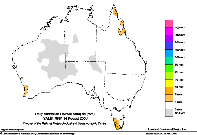
Todays highest rainfall totals for the 24 hours to 9am. It
includes the top 5 totals nationally followed by all reported falls of 50mm or more. |
Highest
and lowest recordings of hours of sunshine for the 24 hours to midnight. |
Highest wind
run totals in kilometres for the 24 hours to 9am (average speed in brackets).
All reported runs >
=25km/h are shown. |
Highest wind
gusts in km/h for the 24 hours to midnight followed by the hour in which it occurred.
All stations with gusts >
89km/h are shown. |
31.0 KOOMBOOLOOMBA DAM N Coast--Barron QLD
27.0 GLEN ALLYN N Coast--Barron QLD
16.0 LAKE MARGARET POWER STATION W Coast TAS
14.4 PORT DAVEY (MELALEUCA) W Coast TAS
14.0 HAPPY VALLEY N Coast--Barron QLD
|
11.1 ALICE SPRINGS AIRPORT N Plateau NT
11.0 GILES METEOROLOGICAL OFFICE Interior WA
11.0 WARWICK Darling Downs E QLD
10.9 TENNANT CREEK AIRPORT N Plateau NT
10.9 RABBIT FLAT N Plateau NT
10.9 MOUNT ISA AERO Gulf Country QLD
10.9 CAIRNS AERO N Coast--Barron QLD
.....
2.3 EAST SALE AIRPORT W Gippsland VIC
2.3 LIAWENEE Central Plateau TAS
1.4 HOBART AIRPORT Southeast TAS
1.3 BICHENO (COUNCIL DEPOT) E Coast TAS
1.3 GROVE (COMPARISON) Southeast TAS
0.6 STRATHGORDON VILLAGE W Coast TAS
|
1042 (43.4) MOUNT WELLINGTON Southeast TAS
855 (35.6) LOOKOUT HILL Western Plains VIC
852 (35.5) KILMORE GAP N Central VIC
800 (33.3) MAATSUYKER ISLAND LIGHTHOUSE Southeast TAS
798 (33.3) COLAC (MT GELLIBRAND) W Coast VIC
776 (32.3) MELBOURNE AIRPORT E Central VIC
751 (31.3) CAPE FLATTERY N Coast--Barron QLD
733 (30.5) COCOS ISLAND AIRPORT Islands ISL
729 (30.4) MOUNT READ W Coast TAS
723 (30.1) NEPTUNE ISLAND W Agricultural SA
720 (30.0) CAPE WILLOUGHBY Yorke Pen/Kanga Is SA
703 (29.3) CAPE OTWAY LIGHTHOUSE W Coast VIC
662 (27.6) CAPE GRIM BAPS N Coast TAS
650 (27.1) DUNNS HILL E Central VIC
635 (26.5) BALLARAT AERODROME Western Plains VIC
609 (25.4) CHRISTMAS ISLAND AERO Islands ISL
603 (25.1) SHEOAKS W Central VIC
|
89/19 ROTTNEST ISLAND Lower West WA
85/18 CAPE LEEUWIN Lower West WA
85/01 WILSONS PROMONTORY LIGHTHOUSE W Gippsland VIC
80/02 MOUNT WELLINGTON Southeast TAS
78/19 SWANBOURNE Lower West WA
|
�