|
 WA: Damaging gales buffet Perth and South West WA: Damaging gales buffet Perth and South West
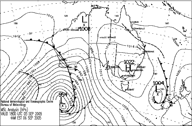
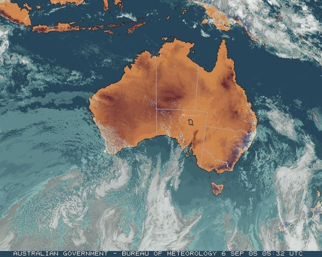
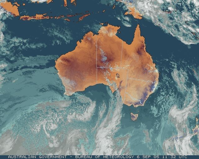
Gales with storm force gusts caused widespread though isolated damage and electricity supply disruption across Perth and the South West overnight and today. An active cold front arrived at Cape Leeuwin about 9 last night. It was preceded by an area of moderate to heavy rain and thunderstorms and was followed by a boisterous westerly stream that continued through today. A trough in the stream crossed the South West late this afternoon, further strengthening winds.
In and around Perth, damaging wind gusts were recorded from yesterday evening into the early hours of this morning, with the worst of the weather passing through Perth between 9 and 11 last night. Rottnest Island reported the top gust of 93km/h. State Emergency Service crews responded to 40 callouts, especially in the suburbs of Morley and Bayswater. The roof of a house in Morley was severely damaged and there were other reports of roof, guttering and tree damage. Power was lost in a number of suburbs.
South of Perth there was minor damage in Mandurah but worse in the towns of Waroona and Harvey, between Mandurah and Bunbury. In Waroona, a house and a garage were unroofed and the wall of a building collapsed. Thousands of properties in Dardanup and Donnybrook, SE of Bunbury, lost power. Wind gusted to 106km/h at Cape Naturaliste at 2.45am.
The trough crossed the Capes early afternoon giving Cape Leeuwin a gust of 113km/h. Strengthening winds brought down trees in the South West, including a large Karri which crashed into two holiday chalets at the Karri Valley Resort, Pemberton, about 4pm. No one was in them at the time.
A broad rainband ahead of the front gave some moderate to heavy downpours last night. Many locations recorded between 10 and 20mm in 3 hours early yesterday evening, with the top falls in the 24 hours to 9am Donnybrook 38.4, Bunbury and Collie East 36.4 and Bickley and Jarrahwood 36.0. Jarrahwood's 36.0mm was just 1mm shy of the town's September record of 37.0mm over the last 30 years.
Newsbits
WA, SA: Warm around the Bight: Both minimum and maximum temperatures were up to 10C above average around the Great Australian Bight today. Nullarbor recorded a top of 33.0C.
QLD: Local heavy showers and storms around Gladstone: The trough that can be seen crossing the coast in the surface 4am and 10am surface charts above generated an unusual line of showers during the early hours of this morning. Small but intense showers developed from about 1am along a ruler-straight line running east from near Biloela, crossing the coast at Town of 1770 and extending through Lady Elliott Island and farther east. Showers along the line moved slowly east, and from about 4am began to diffuse both south and north of the line. They moved out to sea mid-morning and cleared completely between 10 and 11am. Several locations received 30 to 40mm from individual shower cells (see downpours). Heron Island recorded 39.8mm in the hour to 9am |